
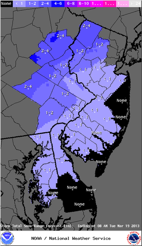
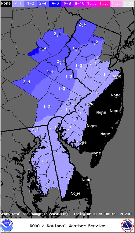
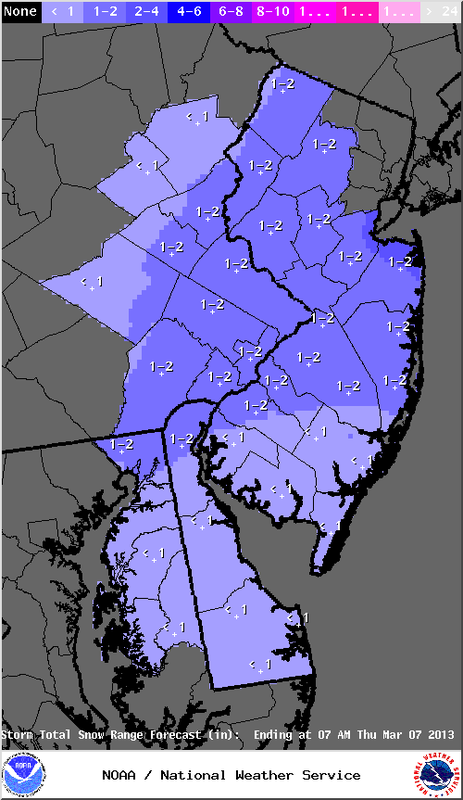
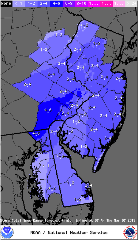
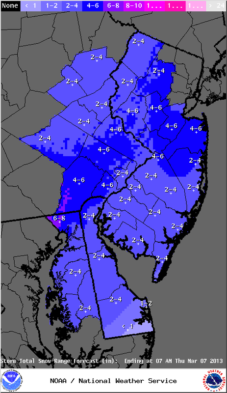
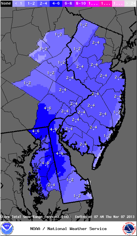
The NWS has trimmed the snowfall amounts slightly for the Easton area, but we can still expect about an inch or perhaps two inches of snow and sleet before a changeover to all rain this evening. It appears the precipitation won't begin until the afternoon hours around the Easton area, thus allowing temperatures to warm a bit before any precipitation falls. There is still a chance for pockets of freezing rain around Northampton and Warren counties (see ice map in previous post). Accumulations should be be mainly on non-treated surfaces, but still be aware if driving. Also, any sleet or ice can change travel conditions quickly. The biggest impact from this system appears to be from the Slate Belt north, where frozen precipitation could linger into Tuesday AM.
This evening's commute will be a messy one, so be aware when traveling.
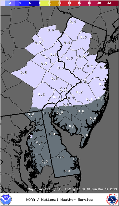
Total liquid amounts will be in the .75" to one inch range, Impacts on streams and creeks appear to be minimal at this time, but will be monitored.
This evening's commute will be a messy one, so be aware when traveling.
Total liquid amounts will be in the .75" to one inch range, Impacts on streams and creeks appear to be minimal at this time, but will be monitored.


 RSS Feed
