
Saturday AM update from the NWS Hazardous Weather Outlook:
A WINTER-TYPE STORM IN EARLY SPRING IS EXPECTED TO BRING WINTRY PRECIPITATION TO MUCH OF THE AREA SUNDAY NIGHT THROUGH MONDAY. THE PRESENT FORECAST WOULD CALL FOR AN ADVISORY-LEVEL SNOWFALL, BUT CONFIDENCE IS LOW AND THE FORECAST IS SUBJECT TO CHANGE.
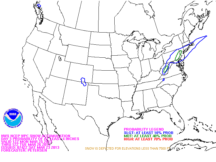
Advisory level for Lehigh, Northampton, and Warren counties is 3" of snow.
The map shows our area having a moderate chance of receiving a 4" snowfall (green outlined area).
Again, this storm forecast has a level of uncertainty with it, so we will have to wait to see how the models handle it as it gets closer to Sunday night.
A WINTER-TYPE STORM IN EARLY SPRING IS EXPECTED TO BRING WINTRY PRECIPITATION TO MUCH OF THE AREA SUNDAY NIGHT THROUGH MONDAY. THE PRESENT FORECAST WOULD CALL FOR AN ADVISORY-LEVEL SNOWFALL, BUT CONFIDENCE IS LOW AND THE FORECAST IS SUBJECT TO CHANGE.
Advisory level for Lehigh, Northampton, and Warren counties is 3" of snow.
The map shows our area having a moderate chance of receiving a 4" snowfall (green outlined area).
Again, this storm forecast has a level of uncertainty with it, so we will have to wait to see how the models handle it as it gets closer to Sunday night.
 RSS Feed
