
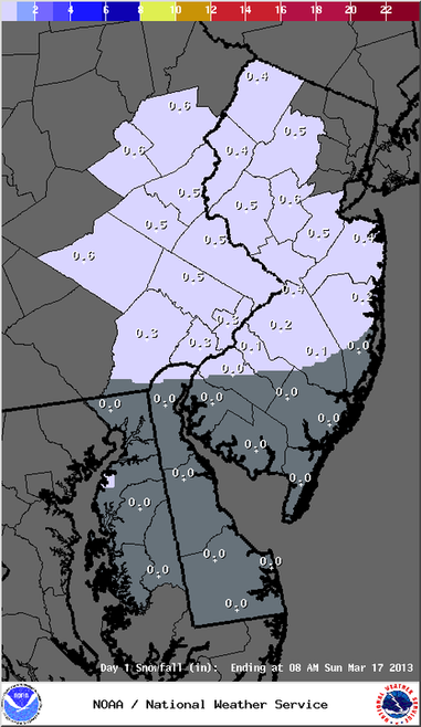
An accumulating snowfall is looking a bit more likely for the Easton area Sunday night into Monday. Nothing is written in stone at this point, as there are still some uncertainties with regards to the exact storm track, amount of liquid within this system, and precipitation types.
From the NWS:
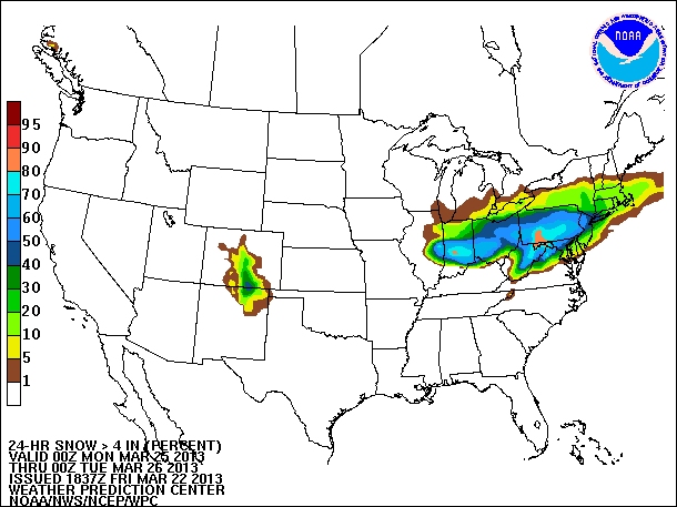
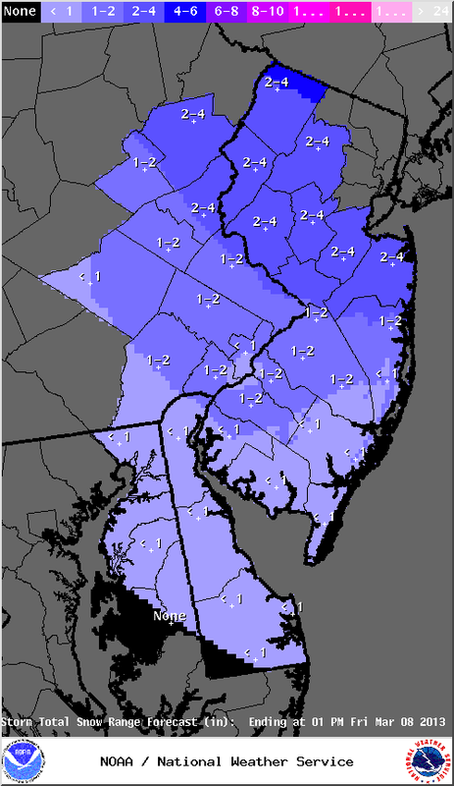
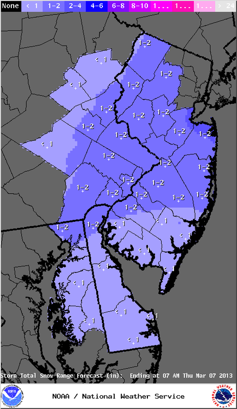
AT THIS TIME...SNOW AMOUNTS ARE EXPECTED TO BE IN THE 2 TO 4 INCH RANGE WELL N AND W OF PHILLY...1-2 INCHES LOWER DELAWARE VALLEY...TO LITTLE OR NO ACCUM NEAR THE SHORE AND SOUTHERN DE. IT SHOULD BE NOTED THAT SOME GUIDANCE LIKE THE LATEST 12Z EUROPEAN MEDIUM RANGE FORECASTING MODEL IS INDICATING CONSIDERABLY MORE SNOW.
The map you see shows the probability of a 4 inch or greater snowfall between 8PM Sunday and 8PM Monday. It is tough to see, but Northampton (PA) and Warren (NJ) counties have a 50-60% chance of receiving that amount of snow according to this forecast map.
This potential event is still a few days away, so there is still some changes that can occur. Stay tuned for another update Saturday.
From the NWS:
AT THIS TIME...SNOW AMOUNTS ARE EXPECTED TO BE IN THE 2 TO 4 INCH RANGE WELL N AND W OF PHILLY...1-2 INCHES LOWER DELAWARE VALLEY...TO LITTLE OR NO ACCUM NEAR THE SHORE AND SOUTHERN DE. IT SHOULD BE NOTED THAT SOME GUIDANCE LIKE THE LATEST 12Z EUROPEAN MEDIUM RANGE FORECASTING MODEL IS INDICATING CONSIDERABLY MORE SNOW.
The map you see shows the probability of a 4 inch or greater snowfall between 8PM Sunday and 8PM Monday. It is tough to see, but Northampton (PA) and Warren (NJ) counties have a 50-60% chance of receiving that amount of snow according to this forecast map.
This potential event is still a few days away, so there is still some changes that can occur. Stay tuned for another update Saturday.


 RSS Feed
